Our first stop of the morning was at Montmorency Falls, taller than Niagara falls, but not nearly as wide, nor as famous as Niagara.
The Manoir Montmorency was at the top of the park, and after a comfort break we started from there.
There were views of the falls as we walked along the path; there were also a lot of steps!
A suspension bridge spans the falls for pedestrians to cross to the other side. I crossed the bridge and Rana gave it a good try.
There are cable cars and zip lines crossing the area below the falls. We did not take the time to do those things.
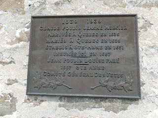
After we left the falls area, we stopped at Ste. Anne de Beaupre, where many of our ancestors were baptized, married, and buried. There is a large shrine to Ste. Anne there, and a history of miracles as well as a rich history of French-Canadian settlers. Below is the Basilica of Ste. Anne de Beaupre.
The old church stands where the original mission was. It is the oldest parish in Quebec, and the most visited.
There is not much left of the old cemetery.
We stopped at the tourist center before lunch, and the young man there told me that there was a 5 K hike to the rim of the crater, told me to take Rue des Montagnes (Mountain Road) up to the National Park, and pointed out on a map which place to stop to pay, and hike from there.
We stopped at Baie St. Paul, a small town famous for its artists' colony and galleries. We had lunch there, which was an adventure in itself--they did not have the sandwich I ordered, so I ordered something else... Like Rana said, we should have asked for the English menu. The mussels were actually pretty good!

There were a lot of moose warnings along the way--this is one of the more sophisticated ones; it has sensors that activate flashing lights when moose are in or near the roadway. As we got higher into the mountains there was snow on the ground, and the lakes were still partially frozen over.
We arrived at the park where the young man at the tourist center said to go, and the woman behind the counter said that there was a 3-4 hour hike we could take, and that we'd be able to see the 2 rivers and IMAGINE the crater. Not what I was looking for! There was internet service there, and I called up a hike someone else posted. We drove further up into the mountains and never did find the hike Bruno recommended.
By then I had hours invested in driving this road, no internet (no mapping), and even the satellite radio had quit working! So I looked at the paper map and decided it was better to continue north and take a different route back to Quebec City. It only took 2 hours to get back via the highway, and when I looked on my computer it appeared that we had been in the crater while driving. Dang.


No comments:
Post a Comment